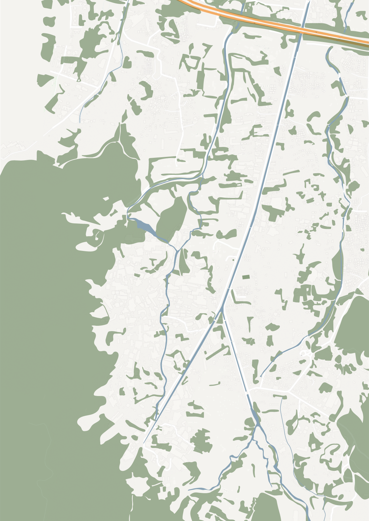
Green Network Analysis
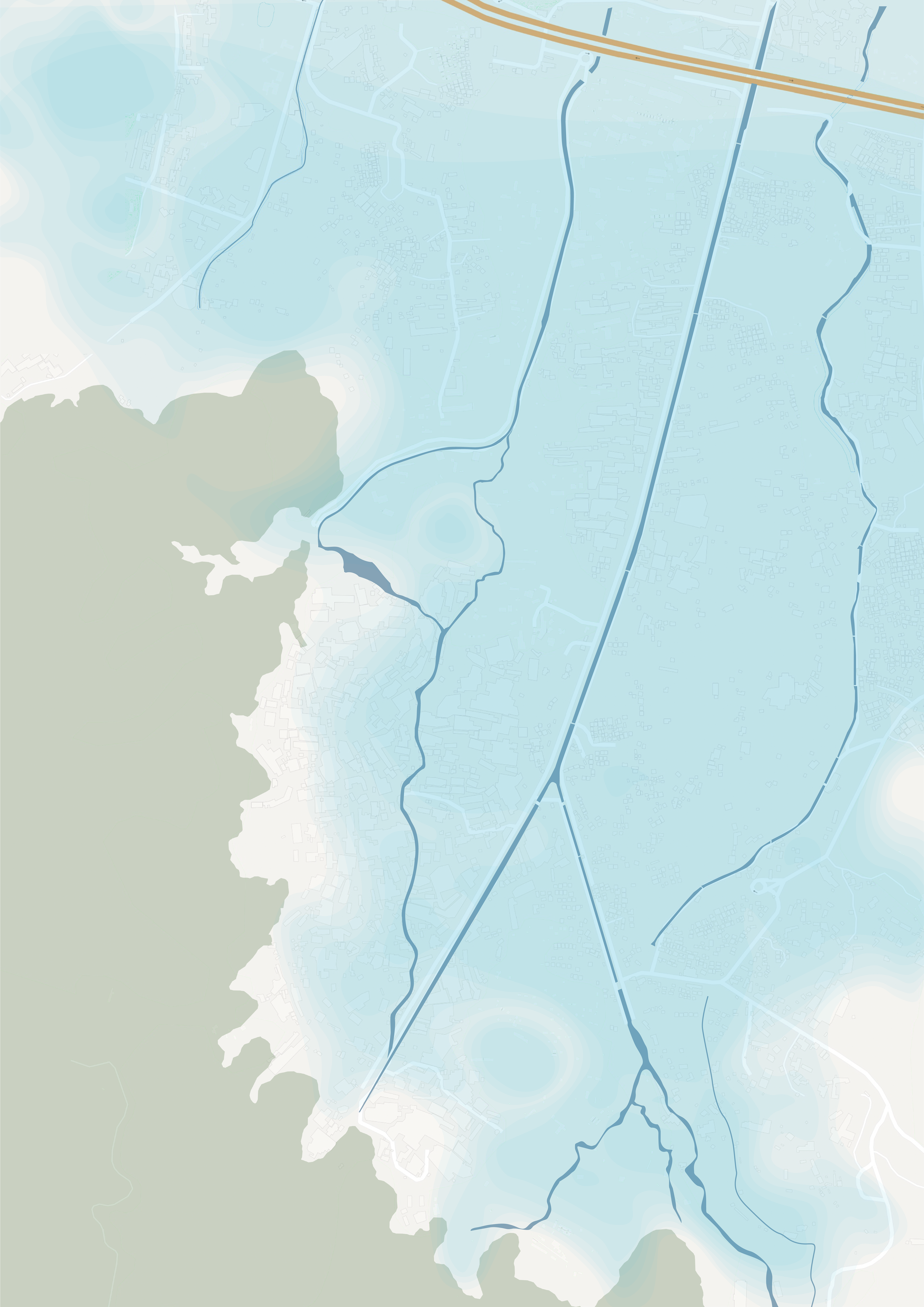
Flood Risk Analysis
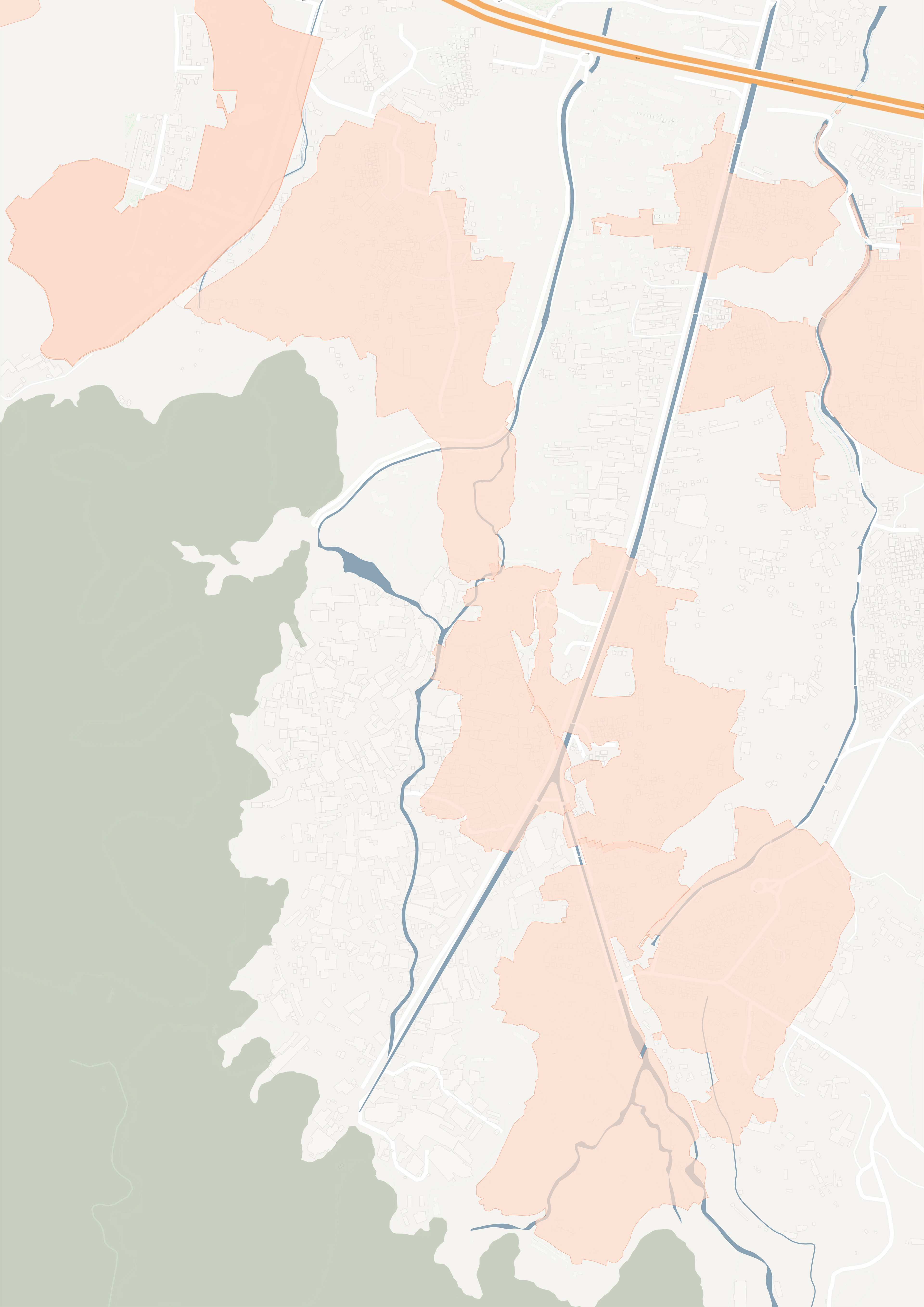
Village Boundary Analysis
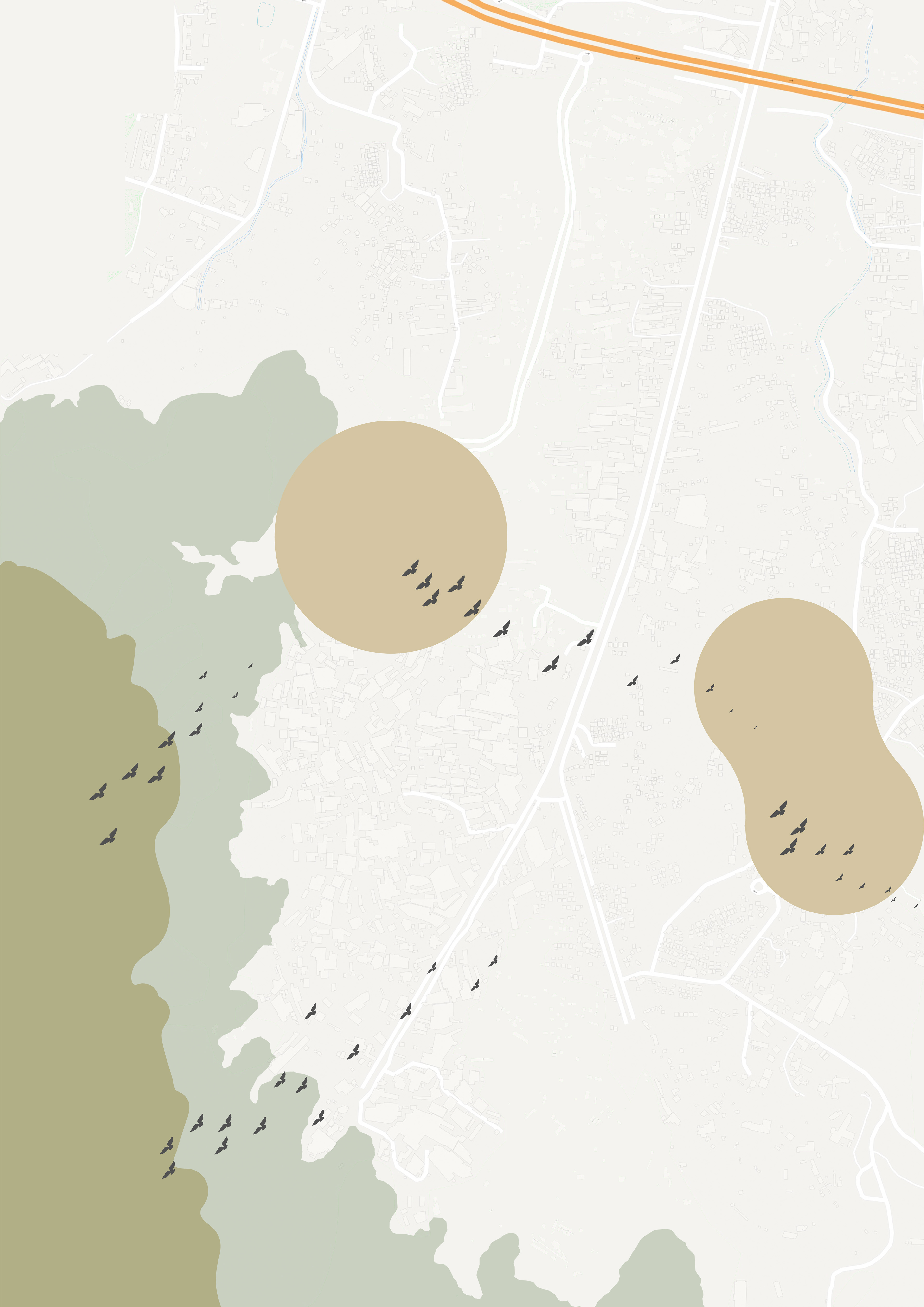
Bird Path Analysis
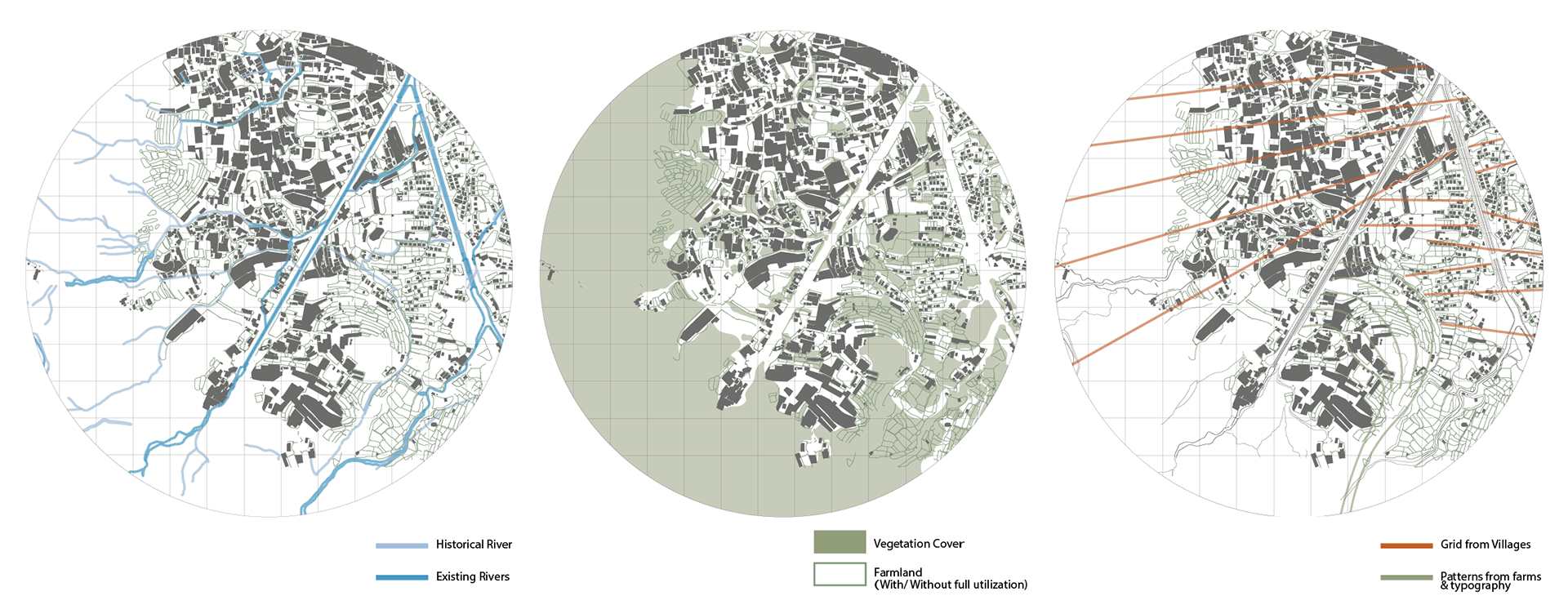

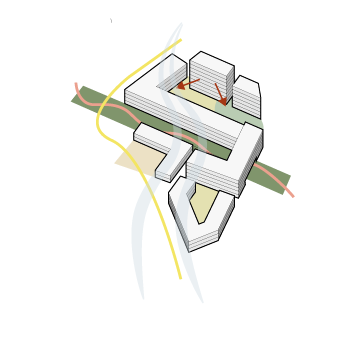
patterns of the villages
after a close study of the typography of both old and new constructions at the site, regular patterns were founded. the grid is twisted to the angle of 9 to 12 degrees to the southeast direction. presumably, it can be related to the sun path and the irrigation pattern of the original farmland.
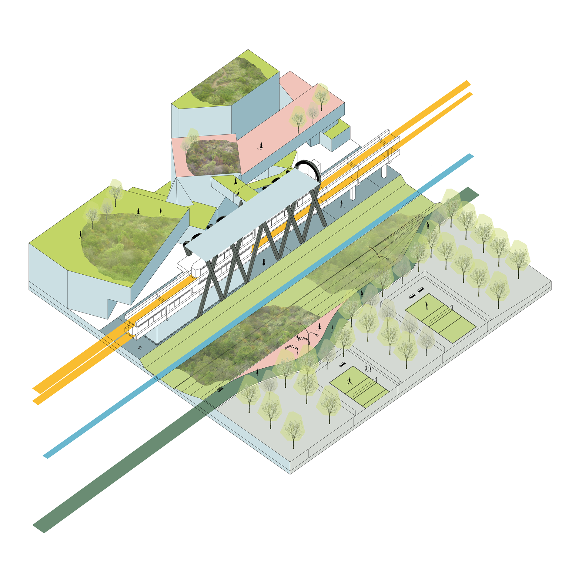
Recreational facilities are also incorporated into the station plaza. People are encouraged to gather around. Furthermore, bike lanes are also connected to the station, and bike parking facilities are provided to support the park and ride.

The stations are connected immediately connected to the green network. The pedestrian can walk through the entire site with the green and blue system.
The station will become a connection joint of the community, and a large podium plaza will encourage users to go outdoors and enjoy the natural environment.
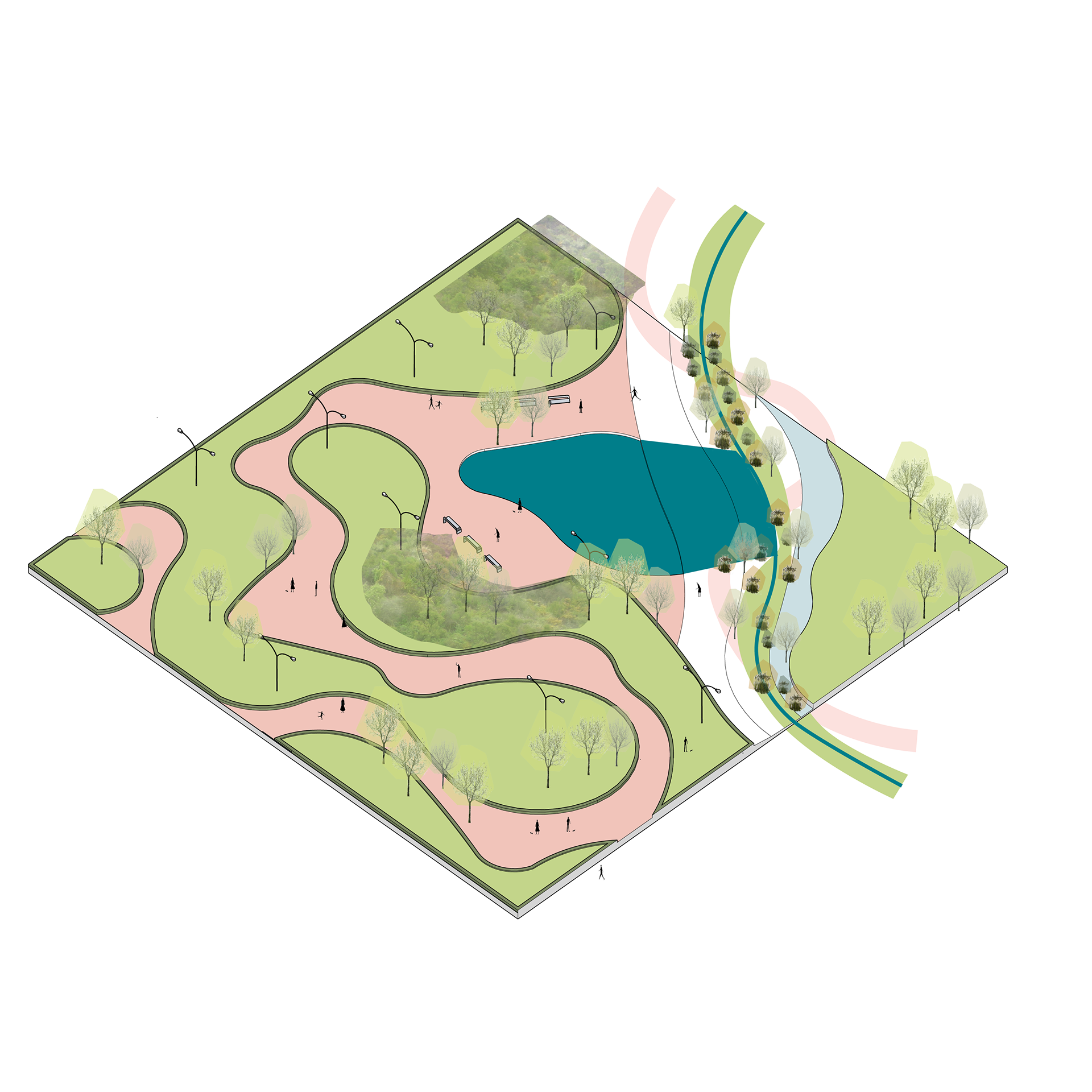
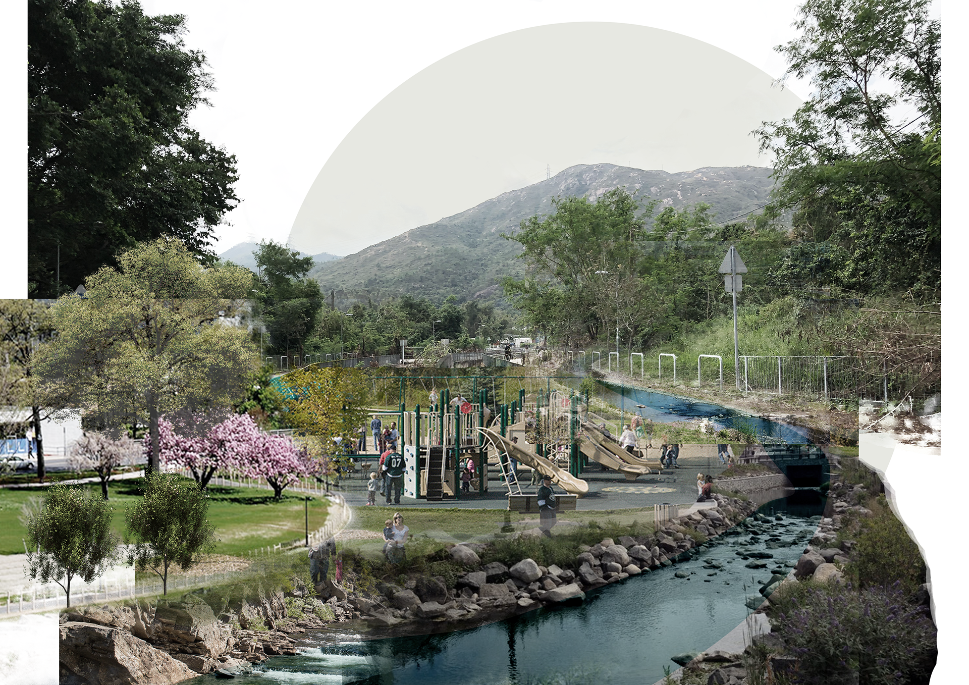
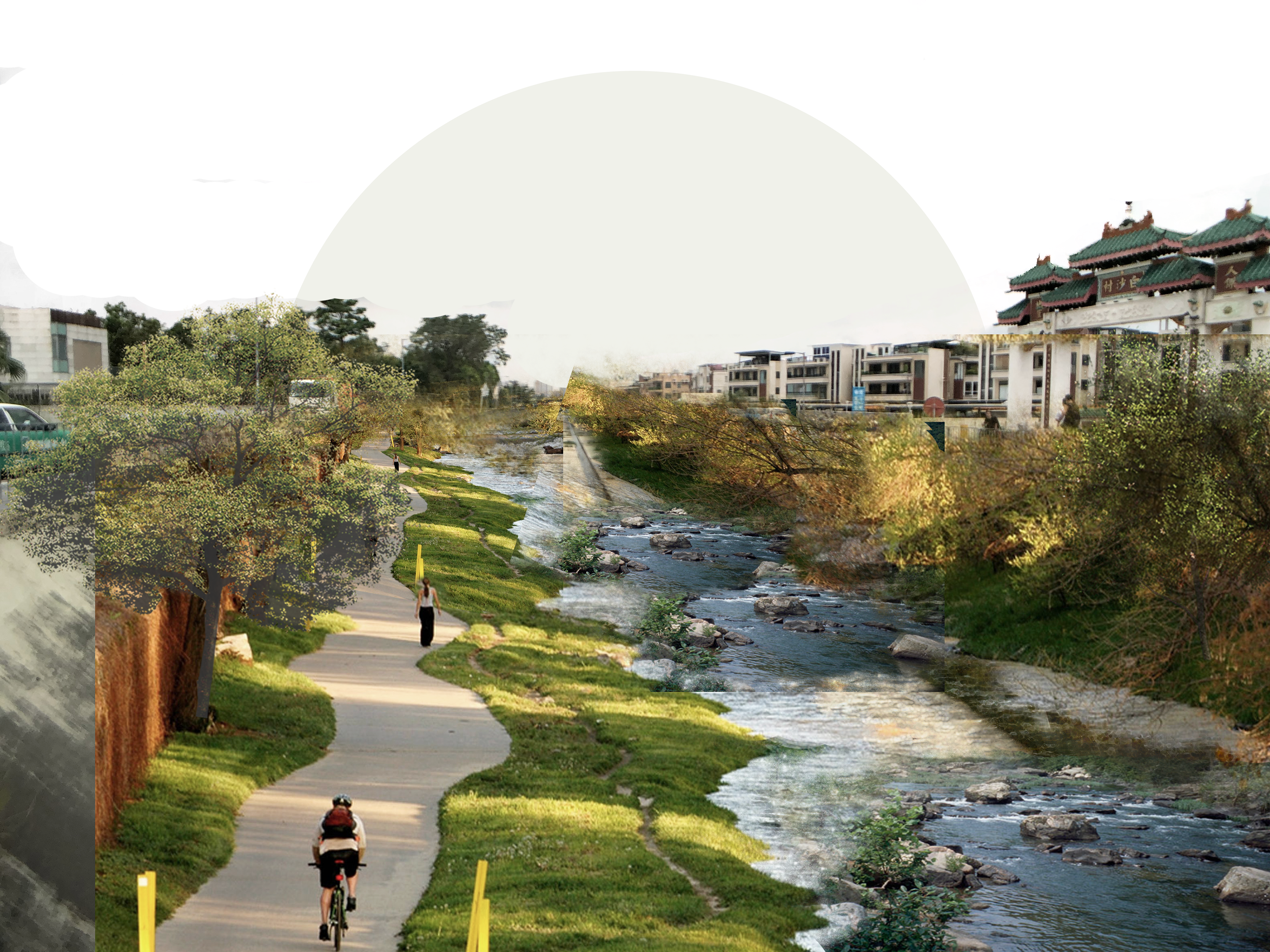
The blue and green infrastructure are linked to form a network of parks, and a seamless connection in between foster utilization of bike lanes and green walkways.
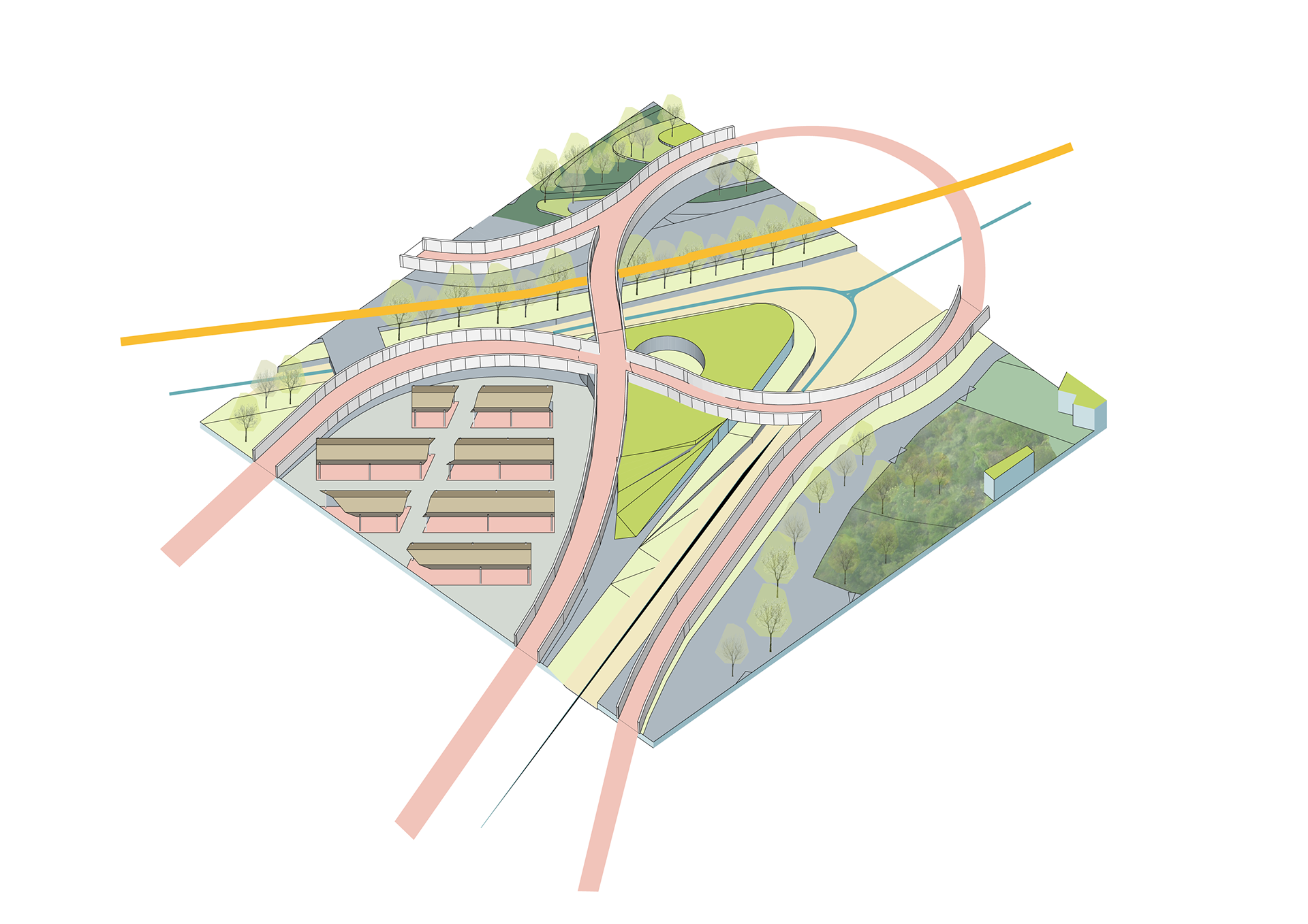
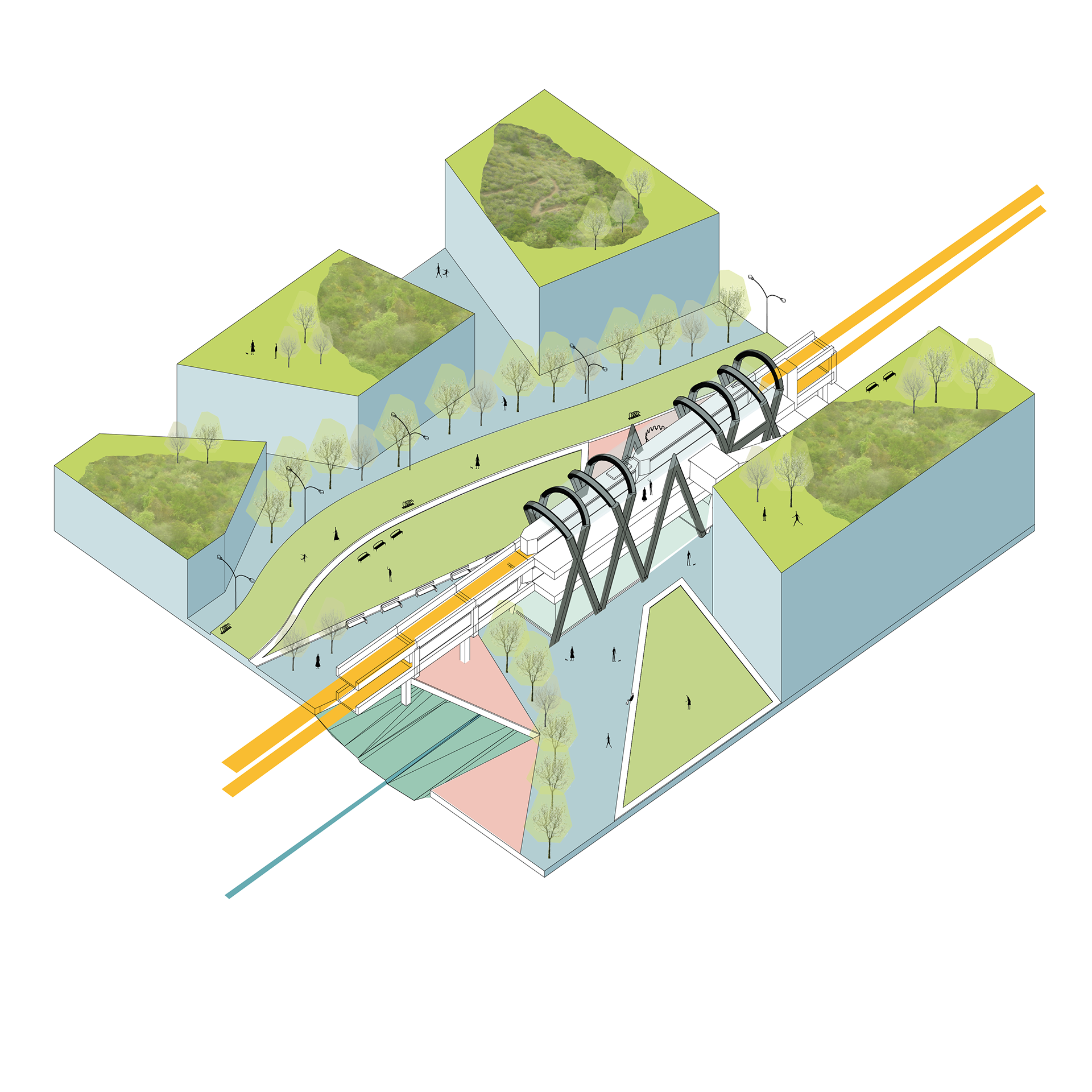
Located at the tip of the nullah, bike lanes joint together. A roundabout allows bikes from all directions to merge. Furthermore, the elevated roundabout created space for a sheltered market in which farmers can bring their fresh products here to do the trading.
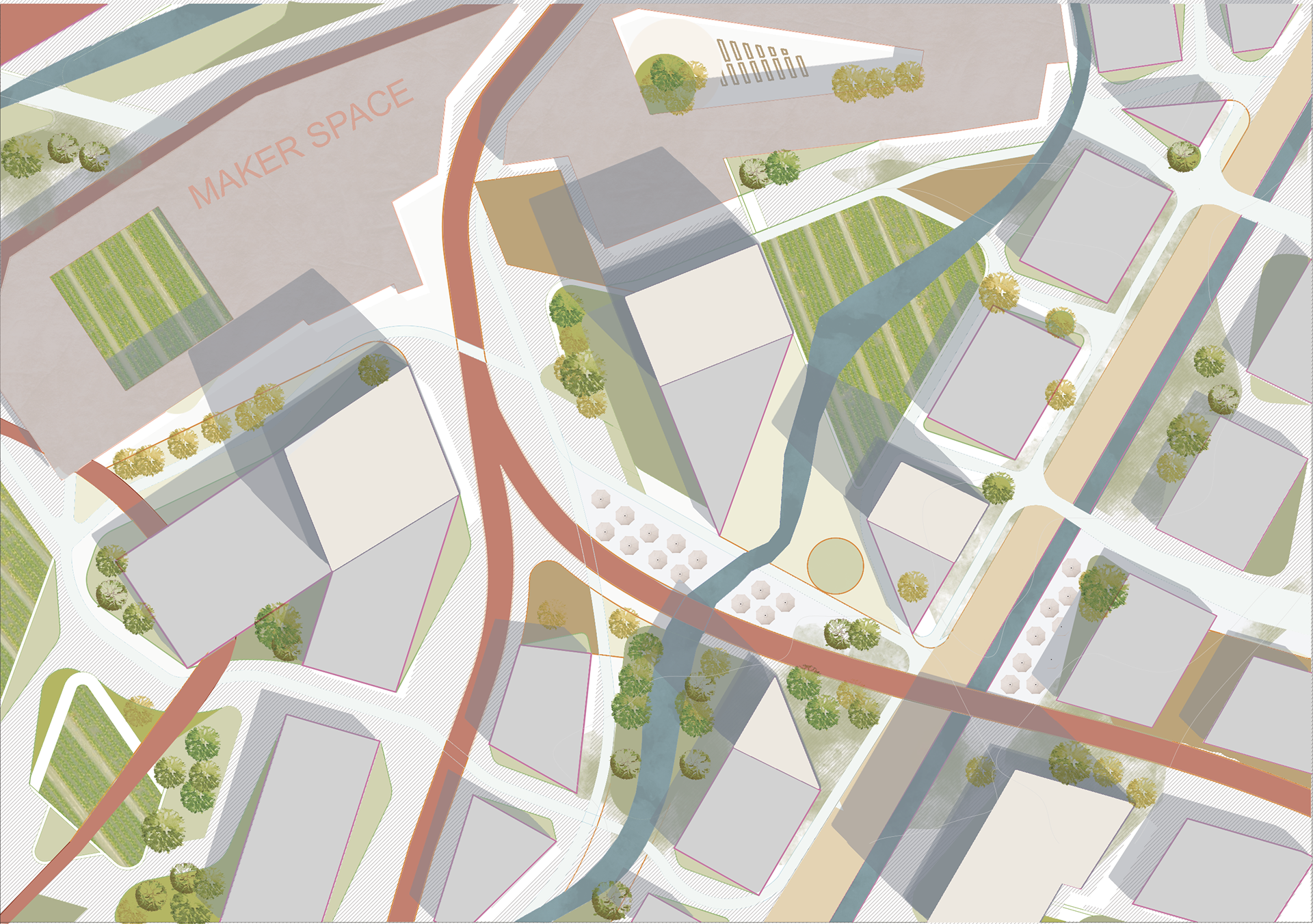
With emphasis, the connectivity between blue & green infrastructure and urban living, this site emerge from brownfield operation to the eco-urban living district. The massing of each block follows the flow of the water streams. Green space was ejected into the living community.
Some of the existing brownfield structures were remained and were revitalized into Maker Space and greenhouses. These nodes in the community can reactivate the neighbourhood connections and foster a new sense of place and locally rooted culture.
The extensive blue & green networks reconnect pedestrians to a local community and reconnect urban living with the country park. This p[orject is about redesigning the relationship that people have with the urban environment.
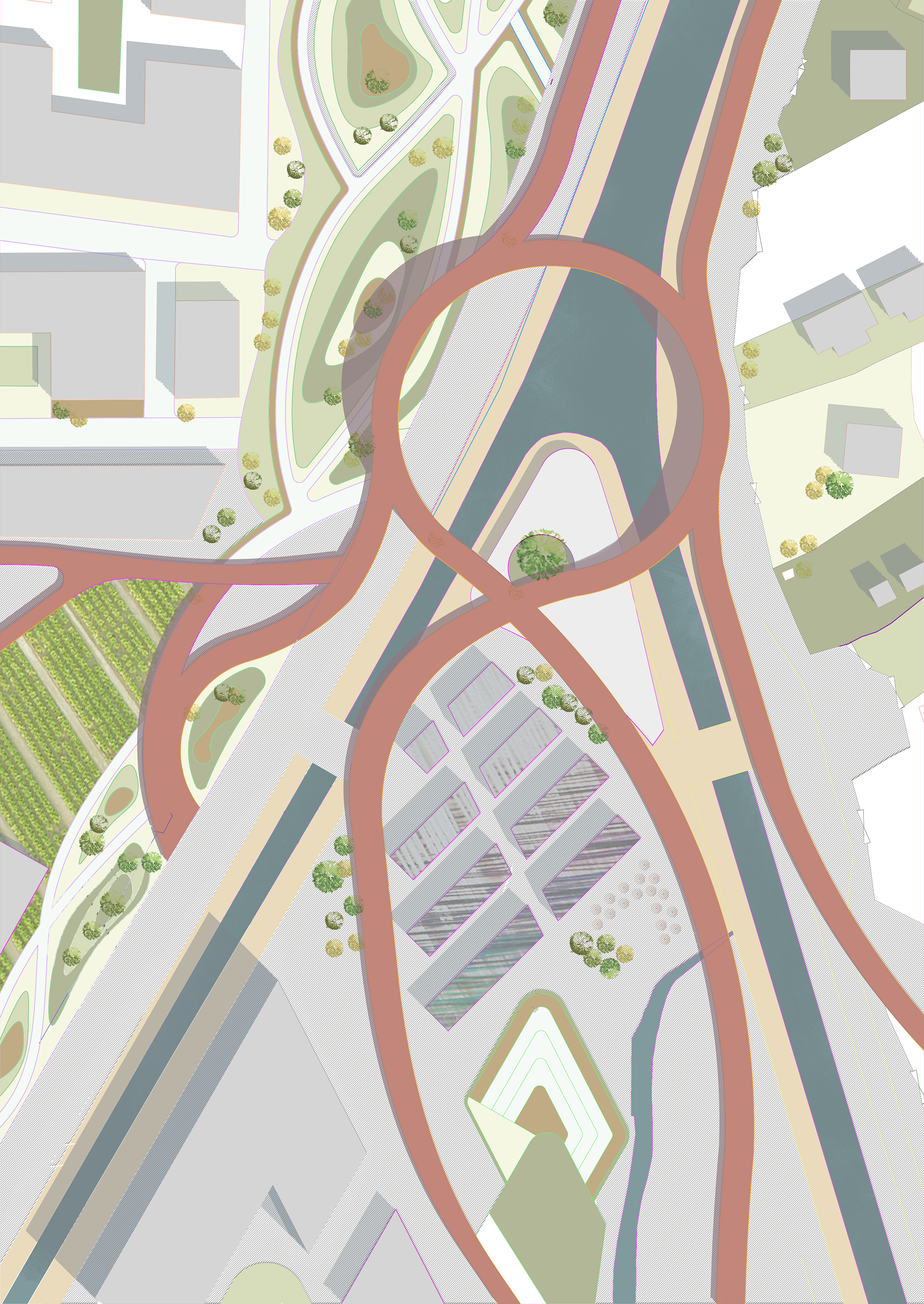
Part plan of “The Circle”
“The Circle” is an elevated roundabout at the tip of the nullah, located in the centre area of the site. Bike lane networks merge at this location. The elevated part also worked as a lookout of the site and people can enjoy the fantastic view of the site. Furthermore, a market is located at the lower part and creates a node for users of the site.

- Wind corridor
- Building mass do not obstruct the original pedestrian path
- Floating blocks to ensure penetration of pedestrian
- Buildings oriented to South
- Smaller building blocks
- Mixed-use
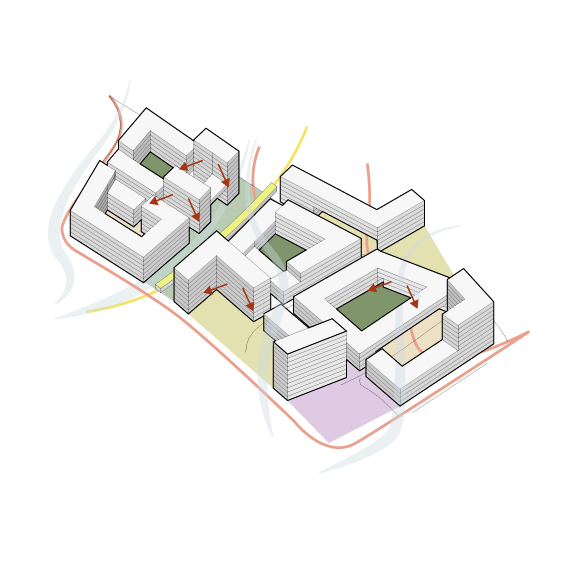
- Mix of slow mobility and light rail network

FACILITATING AGRICULTURE ACTIVITY ON SITE
The blue and green infrastructure also provides opportunities for agriculture activity on site. Brownfields and open storage areas that existed are now cleaned and depolluted. Agriculture activity can now use waters from the nullah and streams for irrigation.

CONNECTING HABITATS
The blue and green infrastructure are formed by farmlands, existing natural green zones, proposed artificial green areas and water systems. The blue and green infrastructure works as a habitats connection and enables migration between the scattered natural habitats. The design of the blue and green infrastructure is tented to provide multiple connections and routes for both humans and natural species.
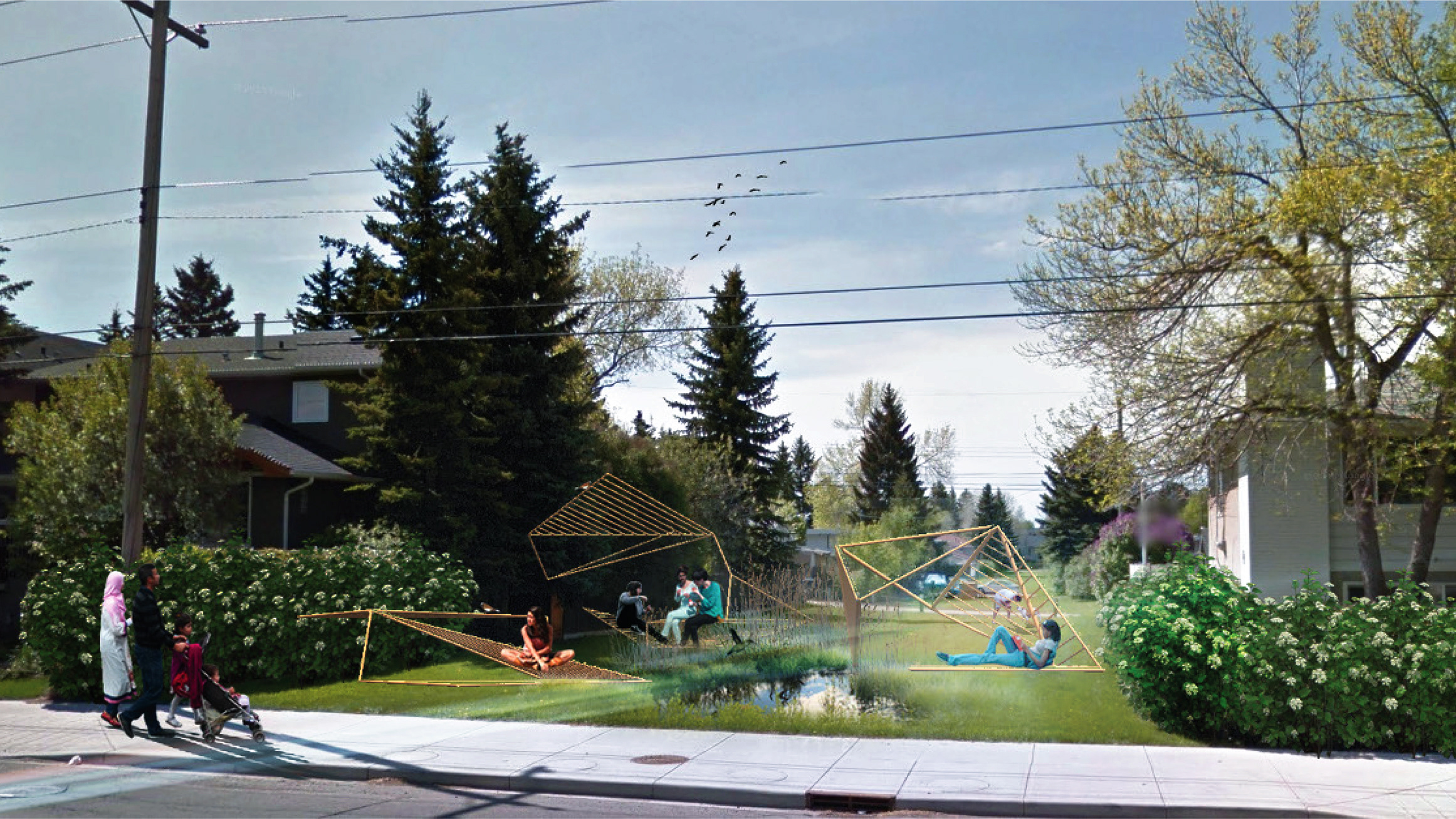
LEASURE & RECREATIONAL
By connecting the blue and green infrastructure, water streams and green areas are improved and being much more connected than before. Besides providing connections for natural habitats, the blue and green infrastructure also enables connections between settlements, including both the new and old communities.
SLOW MOBILITY
We make use of the blue and green infrastructure and make it even more accessible and usable. A network of bike lanes and pedestrian walkways around the site are connected to a Light Rail Transit to ensure accessibility of every inch of the site.